Over the past few weeks, one of my goals was to get out onto my project catchment, the Allan Water, and become familiar with some of the key land and flood management issues present. The development of my understanding of the catchment and its issues is a crucial step in my apprenticeship that allows me to engage with local land managers effectively, and understand their concerns and issues when discussing Natural Flood Management (NFM) with them.
My first trip, saw me visit the River Knaik, a large tributary of the Allan Water. The Knaik tributary is considered to contribute greatly to the flood peak downstream according to a catchment wide modelling study carried out in 2011. So I decided to go out into the catchment during the second day of a heavy rainfall to look at runoff issues and the river itself.
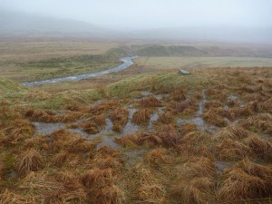
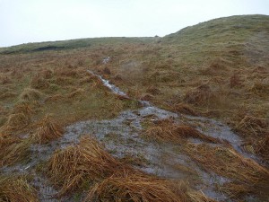
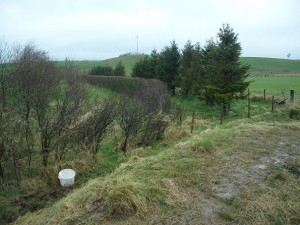
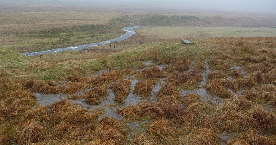
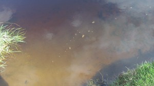
There was a lot of run off on the land and tributaries feeding into the Knaik. The volume of runoff visible was likely a result of the ground being saturated after a day and a half of heavy rain. However standing water was more visible on rough pasture sites (above and below), than on short cropped grass pastures further downstream. Reasons for the difference between the two land types and visibility of runoff may be that sheep have compressed the top soil layer on the short cropped grass pastures making it less water permeable and that the short grass itself gives less resistance to runoff leading to fast sheet runoff. In comparison the rough pasture had channels and pools of runoff created by rushes and long grass that slowed the runoff rate. What’s the significance of this? The slower the water inputs (including runoff) enter the River Knaik, the lower the flood peak will be, and therefore the flood risk downstream is minimized potentially when there are low sheep stocking densities and the pasture is rougher.
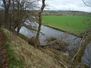
On the following two trips I walked along the Allan Water between Kinbuck to Braco, the contrasting weather in a couple of the pictures will give away the different visits. I came across a variety of places where Natural Flood Management (NFM) had potential to be implemented during the walks. Because it is a large stretch of river I will try and give you an idea of this section and its general issues and potential for NFM, as apposed to what was round each meander. However, just to contradict myself to begin with, on the first trip near Kinbuck I came across something very interesting, two large trees had fallen into the river and created a lovely back water channel. The result of this was that the river had made a new channel separated from the backwater by an island (bar), which increases in-river habitat diversity and slows the water flow, so in short, this is nature’s very own NFM project, and it wasn’t far from this site that I came across otter footprints.
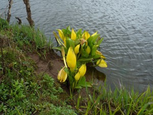
On the banks of the Allan Water, I also came across two invasive non-native species (INNS) of plant known as hogweed and skunk cabbage. INNS are damaging to the natural environment, as they outcompete native plant species, alter the natural ecology and reduce biodiversity. An important reason for the reduction in biodiversity is that native insects life-cycles have evolved to use native plants, and not the INNS species. Therefore native insects and the predators that feed on them can be reduced by INNS presence, so although it wasn’t a good sign, it was an interesting one to note.
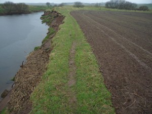
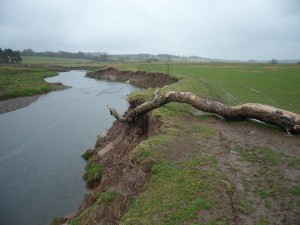
The environment around the river along this stretch could be generally classified as flat farmland protected by an old dilapidated embankment and river banks that have suffered from erosion. The bank erosion has led to a lot of fine sediment being deposited on the inside bends of the river and there was evidence of it on the river bed, which is concerning to farmers that are loosing their fields, creates an unfavourable environment for salmonid fish species and can reduce in-water habitat diversity. The bank erosion picture below shows how the river has eroded away the embankment in the distance and how the buffer strip between the field and bank edge is very narrow, and treeless. Riparian trees naturally slow water down and their roots hold the bank together, therefore creating stable banks. However treeless banks that were severely eroded were a common feature of the river throughout this stretch, and I’m sure bank protection will be a topic of interest to land managers here.
Sediment coming out of a drainage ditch into a river, gravel bed in the top left of the picture is covered in sediment
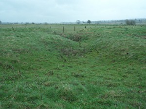
The embankment itself was also breached or had completely vanished in some areas allowing water onto the old floodplain which is now farmland. From an NFM point of view that is quite good as it allows the river to access the land, and the land to hold back some of the flood water that would otherwise go straight downstream exacerbating the flood peak.
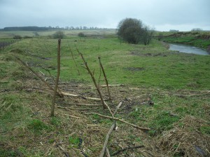
The are some large parts of the Allan Water, where low areas of land occur between the river and the embankment. The significance of low land beside the river is that flood water accesses this land most frequently and therefore it is ideal for riparian tree planting that would slow the water flow even during the earliest stages of flooding. In addition, the riparian trees would stabilise the banking, create a habitat corridor and increase biodiversity. An ideal flat area inside the embankment is shown in the photograph below, the INNS hogweed stalks are also visible in the foreground of the picture, and were fairly common along the river bank.
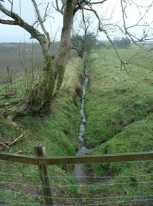
As with most farmland, drainage ditches were fairly common. Drainage ditches can be made to be less efficient, which reduces the speed of water flow and makes the ditch hold more water in non-flood periods. The result of this is the drain gives a slower input into the main river system during the build up to a flood, but during a flood does not effect drainage which would result in farmers being unable to drain their land after a flood event. Along this stretch of the Allan Water there are some potential drains (see picture below) that could be made less effective in this manner and may help mitigate the flood peak.
In addition, hedges perpendicular to the river are also an advantageous NFM strategy on flat farmland beside rivers that flood. The reason for this is that it creates a leaky barrier that slows the flow of the flood water across the land when the river “bursts it’s banks” (see first photo below). The hedges keep flood water on the land for longer, minimizing it’s contribution to the flood peak. The second picture below highlights the flat farmland above the river bank, which from an NFM point of view would benefit from hedges, and the size of log deposited on the bank highlights how high and powerful the Allan Water can flood.
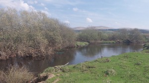
To finish with, the picture below is from the nice sunny day on the second trip, where I came across a great section of natural riparian trees protecting the bank from erosion, slowing the flow of water and increasing habitat diversity and biodiversity effectively. It has been great to get out into the catchment and familiarise myself with the issues and possibilities for NFM at some of the key sites over the past 3 weeks, and hopefully it will stand me in good stead when I discuss NFM potential and possibilities with the local land managers.
